biking, obviously, is the most imoortant thing to me in making this city work again. i was in denver over winter break, let me tell you, that is a biking city. every street has a bike lane, not to mention their own version of this very project that goes to the fouthest south suburb. that is an odd place, the sprawling city in the country with a metro area about the size of ours with a population about half. it's nice there. i like it, but it's still not st. louis. it's always home.
- 1,649
Jambo wrote:The Urban Review - St. Louis web site has a link to the Urban Land Institute (ULI) Chouteau Lake/Greenway design competition. The ULI site has a QT MOV video that is well produced showing a historical "vignette" of the lake/pond area and the proposed developments for the Greenway et al.
Since the http://www.chouteaulakedistrict.com website by McCormick Baron and Associates hasn't been online for sometime, it looks like while the Gerald D. Hines Student Urban Design Competition is taking place, the http://www.udcompetition.uli.org website is a good source of information on the Chouteau Greenway Plan. There are images of the Greenway Proposal at Midtown as well as how the entire greenway will link downtown with Forest Park as well as Tower Grove Park.
Link: http://www.udcompetition.uli.org/
Very cool. Thanks for the link. If this - http://www.udcompetition.uli.org/images ... ayPlan.pdf - ever gets finalized and completed it will be quite an improvement over the current view as you drive along the highway.
I'd still like to see this project even more ambitious. More green, and residential along Chouteau.
I dont see how the lake can be a success from what I see in this image. The freeway blocks the north, Parina to the south, and Tucker on the west. It seems isolated. Then it seems they included railroads that they can't relocate, which creates a greater wall.
![]()

Xing wrote:I dont see how the lake can be a success from what I see in this image. The freeway blocks the north, Parina to the south, and Tucker on the west. It seems isolated. Then it seems they included railroads that they can't relocate, which creates a greater wall.
I sort of agree. They really need to move the railroads somewhere else. If they are going to do a project this big, they might as well go all out. I really think they should make the big lake at least go from 8th to 14th, if not 17th (or long enough that crew races can take place on it). This string of office park lakes isn't going to cut it.
Moving the railroads is much easier said than done, especially in this part of town. The rail line through this area is a vital link to the MacArthur Bridge as well as to the section of the line that travels north through the Arch grounds and past the Landing.
I think the most important thing is to make the lakeside itself attractive, especially the part next to Cupples and the new ballpark.
I think the most important thing is to make the lakeside itself attractive, especially the part next to Cupples and the new ballpark.
Xing wrote:I dont see how the lake can be a success from what I see in this image. The freeway blocks the north, Parina to the south, and Tucker on the west. It seems isolated. Then it seems they included railroads that they can't relocate, which creates a greater wall.
I think we need to define what "success" means for this project. If you're imagining it being lined with residential buildings and businesses, then the barriers you mentioned above will probably keep it from happening. It will be much nicer than an old railyard and will provide a beautiful and easy bike connection between forest park and downtown. That will be all the success I need.
Yes, but there are so many parks in St Louis with freeways along side them, large avenues keeping people away, and other barriers. Just look at the arch grounds above. They're spending a lot of money just to connect a piece of it to downtown. Why not fix the problem before it's created?
ok I understand what you mean. I'm just looking at it primarily as a beautification project and a bike corridor, neither of which depends on people being able to filter in and out of it along the edges.
The archgrounds, however, were never envisioned as providing transportation from one place to another, and therefore it might've been forseen that it would suffer from a lack of pedestrian connections.
If this gets built, on a nice day I would expect to see a level of activity similar to the joggers/bikers at forest park, which I would say is considered a success. I think more people will cross under the freeway than you think, once they see what's there.
I'm with Xing.
This has been a project that I've always had atop my list. And one of the original pics (I think came from HOK) was much more ambitious looking. Although the detail wasn't as prevalent.
![]()
This is closer to what I had in mind. I just think we have an opportunity to really connect the near southside with the CBD, and this is a way to make the transition smooth, and aesthetically pleasing.
Personally, I have the intercoastal waterway in mind when I think of the potential of Chouteau Lake. The Intercoastal Waterway are the inlets of water between the mainland and the beaches in most of the major Florida cities. They have majestic bridges going across, and the water is beautiful. It is really unique, and that's the sort of ideal that I'd like to see.
![]()
![]()
![]()
![]()
Why not St. Louis?
This has been a project that I've always had atop my list. And one of the original pics (I think came from HOK) was much more ambitious looking. Although the detail wasn't as prevalent.

This is closer to what I had in mind. I just think we have an opportunity to really connect the near southside with the CBD, and this is a way to make the transition smooth, and aesthetically pleasing.
Personally, I have the intercoastal waterway in mind when I think of the potential of Chouteau Lake. The Intercoastal Waterway are the inlets of water between the mainland and the beaches in most of the major Florida cities. They have majestic bridges going across, and the water is beautiful. It is really unique, and that's the sort of ideal that I'd like to see.


Why not St. Louis?
trent's point still applies. Why not extend the waterway all the way up 10th to Market, for example? Imagine the new Market having a boathouse.
The overhead rendering (as Xing posted) has a few interesting quirks. It looks like there's a disconnected lake at 8th by the stadium; why isn't that connected under 40? I also find it noteworthy that the placement of the word "Chouteau" nicely conceals that a large piece of lakefront property will be Purina's surface lot.
I hope they make that path wide enough for cyclists and pedestrians to share. The length of it alone will draw a lot of fast traffic that presently uses Washington or Olive.
While I'm rambling... the current SUV-friendly standards for overpass walls usually make it impossible for most passenger vehicles to see off the side. IT will be a terrible shame if those Tucker (labeled 12th in the map) and 14th Street viaducts don't offer most drivers a view of the lake(s).
phobia wrote:
While I'm rambling... the current SUV-friendly standards for overpass walls usually make it impossible for most passenger vehicles to see off the side. IT will be a terrible shame if those Tucker (labeled 12th in the map) and 14th Street viaducts don't offer most drivers a view of the lake(s).
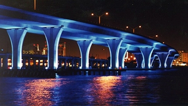
I agree. I know it won't happen, but imagine the bridges like the one on Tucker are entirely mesh on the sides so if you're biking across you could see the water underneath? I guess we can dream.
- 1,610
While the viaduct sidewalls may restrict motorist views of the new lake below, at least MetroLink partons will have decent ground-level views of the new lake.
- 1,054
I prefer the HOK original design because it includes housing on the northern extent next to the highway. Living that close to the highway is not the best, but having housing there is beneficial to closing the gap and making the transition between downtown and Chouteau worth it. It would also be inviting to pedestrians.
Granted the new map includes a great park for its western extent at Forest Park Southeast that is needed. Replacing the railways is not an option unless some are unused currently. Trains may be used more in the future. We could be like Chicago and build above them or learn to live with them and install sound reduction barriers other than cement walls.
Granted the new map includes a great park for its western extent at Forest Park Southeast that is needed. Replacing the railways is not an option unless some are unused currently. Trains may be used more in the future. We could be like Chicago and build above them or learn to live with them and install sound reduction barriers other than cement walls.
Not living by an ocean is completely beside the point. The Intercoastal Waterway is between two parcels of land. It could just as easily be a lake, except that it has access to the ocean.
The point was that we can think big on the project and not be shortsighted. This is the one project, IMO that can really tie everything that's happening downtown with the rest of the city. The current design looks subpar to me. Don't get me wrong, I still think it's progress, but why stop there?
The point was that we can think big on the project and not be shortsighted. This is the one project, IMO that can really tie everything that's happening downtown with the rest of the city. The current design looks subpar to me. Don't get me wrong, I still think it's progress, but why stop there?
I will agree that there are parts of the design that worry me. The train crossing over the lake, not so much, as I love to watch trains. But I still prefered the older options that either burried the lines or left them to the far southern end of the lake.
As for its over all potental, I worry that convincing development to procede in an area so clearly criss crossed by elevated rails and roads might be hard. I mean look at the way that map is divided up. The only option is density to over come it, but as trent said, without those options close to the highway, i wonder if it will be able to truely link together north and south.
As for its over all potental, I worry that convincing development to procede in an area so clearly criss crossed by elevated rails and roads might be hard. I mean look at the way that map is divided up. The only option is density to over come it, but as trent said, without those options close to the highway, i wonder if it will be able to truely link together north and south.
The tracks cross the lake because they have to get to the new Multi-modal center. The tracks can't go under because they would have to get below the sewer line, and the grade would be too steep to do that. At grade tracks don't make sense to me though. If the tracks were elevated in a nicely designed bridge, we could have a great compromise.
I agree on the residential along the highway. I think that is very important to this project succeeding.
I agree on the residential along the highway. I think that is very important to this project succeeding.
- 1,610
These tracks are part of main lines for BNSF and UP. The tracks are elevated between the River and 7th, going over roadways to the east of an including South 7th. Then, the tracks transition to at-grade to go below the Tucker, 14th and 18th viaducts (as well as Jefferson, Compton, Grand, Chouteau, etc. beyond downtown). In other words, any change in elevation to the tracks would not only disrupt service on these main lines, but also likely change clearances over and under the many roads connecting South City to the Central Corridor.
- 3,466
How about this idea: Build Chouteau Lake right over the railroad tracks. The tracks would be underwater and invisible in the daytime. Then each evening after 11 PM, the lake level could be lowered a little (pumped to a separate holding area) to expose the tracks and allow trains to operate from 11 PM to 6 AM only.
That seems like an awful lot of work, when you could just move the tracks.
I think they should lower the tracks, and build a water-tight glass tunnel around them so train conductors, (and they should run trains through there with passengers from Union Station, maybe also the Metrolink) can see people boating and surfing above them. Did I say surfing? Yep, because they'd also install a huge wave making machine! Awesome.
- 1,026
I wonder if the lake could be made deep enough to "tunnel" the trains through it ... woudl be very cool though.
My two cents: the lake is only worthwhile if it encourages a tremendous ammount of development in downtown south. The idea was never to build the lake just for eye candy .. we weren't going for the fake suburban-office park lake (and actually such a thing would diminsh downtown in my opinion).
The new rendering does not have any development along its northern edge - and I'm not sure it even allows enough space for it. That HAS to change. The lake is about generating development. Read Baron McCormick's original plan for the thing - thats why he wanted it. If it's just goign to be a "water feature" st. louis would be better off throwing that money at metrolink.
^Can't agree with you more, Mark. I have always been a bit skeptical about this project. I too worry that it will just end up being a big pond with even bigger ponds of parking lots surrounding office park-type buildings.
If done right, it would be a huge coup. I'm just not counting on it.
If done right, it would be a huge coup. I'm just not counting on it.