Tapatalk

Bicycle City

Bicycle City

3,428
Life MemberLife Member
3,428

PostMay 24, 2017#1

Joe Holleman wrote a piece for the Post a couple of weeks ago that said St. Louis moved up a notch on the Bikleague.org report cards on bike-friendly communities. From Bronze up to Silver.
http://www.stltoday.com/lifestyles/colu ... aaaff.html

I went to the web site, and it is pretty comprehensive about creating report cards for cities and providing suggestions on how to move up the ranks. They have 4 levels -- Platinum, Gold, Silver, Bronze and, I guess, nothing for cities that either don't apply or don't meet even the Bronze level criteria. Here is the report Card for St. Louis:

http://bikeleague.org/sites/default/fil ... uis_MO.pdf


I was curious about how where other big cities stood with respect to bike-friendliness as reported by this site. I looked up the status of the core cities of the 50 largest US metros and made a small table. Here it is. I'd say St. Louis is in pretty good company.


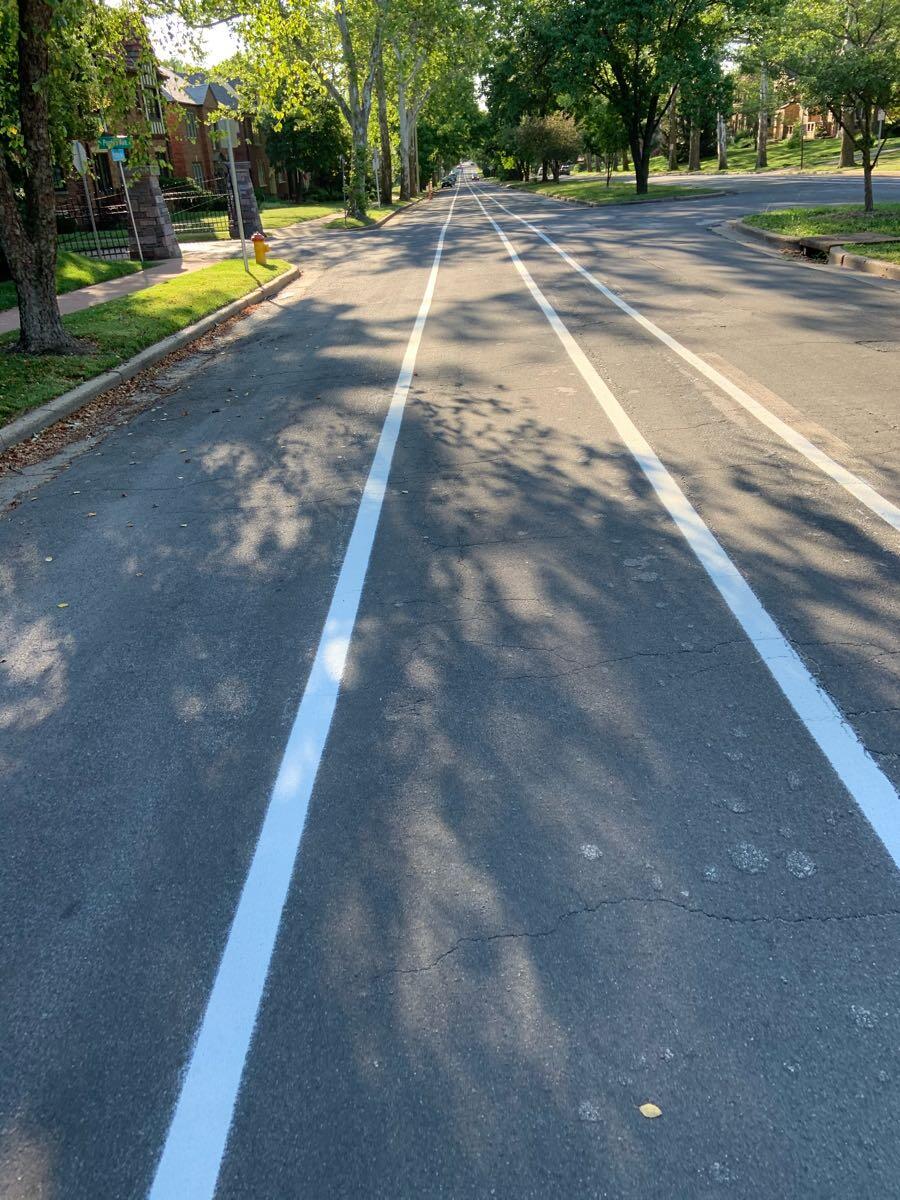
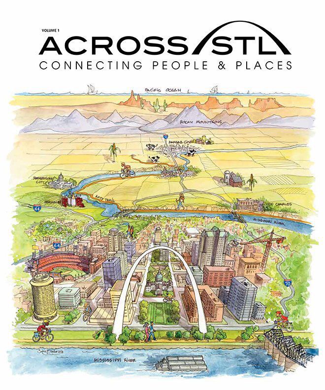
Just today, Joe Holleman wrote a new piece for the Post about local biking and hiking and Trailnet's new magazine.
http://www.stltoday.com/lifestyles/colu ... 5aafb.html


Moving up in the biking world.

985
Super MemberSuper Member
985

PostMay 26, 2017#2

Curious if there is any consideration of surrounding areas outside of the main city for these rankings. Since there are a number of suburbs that have rather bike friendly communities and are increasingly connecting with each other. One of the near term ones is connect up the trails around River Des Peres which will as a result have off road bike paths connecting South City to large parts of South County as far out as Kirkwood.

There is definitely a few noticeable gaps that would be nice to see filled in. Mainly deal with making some bridges along the rivers bike friendly. and eventually have a gap-free route of off road and bike friendly road routes going from the city to the Katy Trail. Especailly as in the near future the 2nd statewide trail gets built.

307
Full MemberFull Member
307

PostMay 26, 2017#3

imperialmog wrote:
May 26, 2017
eventually have a gap-free route of off road and bike friendly road routes going from the city to the Katy Trail.
It's not that far from being a reality. The central corridor is very bikeable from downtown STL to Forest Park to downtown Clayton. The toughest part from there is how to get to Creve Couer Park. Once at Creve Couer Park, a paved, completely-separate-from-car traffic trail exists from there to the Katy.

985
Super MemberSuper Member
985

PostMay 26, 2017#4

Yes, some parts through clayton need to be worked out. There is the Centennial trail part along 170 that's a nice piece to it. (note there is discussion on sorting out the intersection with Delmar since its a bit complicated) Also they are working on connecting Creve Coeur Lake with the Maryland Heights Aquaport now which will at least get it closer. Also there is plans on using some utility corridors as bikeways since they can be nice native grassland areas.

I know where I live out in Washington there is several bike trails being planned soon to go with existing riverfront trail (half is closed now for new bridge construction) and bike lanes along 100. One is go upriver to connect some parks together and another is go along a creek through town connecting schools, parks, and neighborhoods together. Also the river bridge being built will have a bike path along it and the construction of a connector route to the Katy Trail. There is starting to be talk too on some sort of route to try to connect to the trailhead of the Rock Island Trail in Beaufort which could in time provide access from the City of St. Louis to the start of that trail.

6,117
Life MemberLife Member
6,117

PostMay 27, 2017#5

Actually, one nearly already does. The riverfront trail extends across the Chain of Rocks bridge and basically links up with the Madison County Transit Confluence Trail, if you accept some shared alignment across a lightly used bridge. After that you can bike up to Alton on dedicated trail and cross back over the river in a bike lane. After that the trail isn't quite finished, but it surely seems to me as though the West Alton Trail is aiming to link up with the Katy Trail at Machens. There's still a gap, of about seven miles that needs to be plugged with 94. That's . . . non-trivial. But solvable. Of course, that's a bit out of the way, but it's all there. And it will be solved quickly, I expect.

3,428
Life MemberLife Member
3,428

PostMay 30, 2017#6

imperialmog wrote:Curious if there is any consideration of surrounding areas outside of the main city for these rankings. Since there are a number of suburbs that have rather bike friendly communities and are increasingly connecting with each other. One of the near term ones is connect up the trails around River Des Peres which will as a result have off road bike paths connecting South City to large parts of South County as far out as Kirkwood.

There is definitely a few noticeable gaps that would be nice to see filled in. Mainly deal with making some bridges along the rivers bike friendly. and eventually have a gap-free route of off road and bike friendly road routes going from the city to the Katy Trail. Especailly as in the near future the 2nd statewide trail gets built.
ST Louis City is one of seven communities in Missouri considered bike-friendly by this group. On the map at this link, click on or touch Missouri and scroll down.

http://bikeleague.org/bfa/awards


291
Full MemberFull Member
291

PostOct 22, 2017#7

Article about bike lanes in the Twin Cities.

Based on my recent trips back to Minneapolis, I have to say that on street bike lanes have reached a point where they are really having an impact on auto street capacity in towns that have growing populations. It is remarkably different than Saint Louis. I say that as someone who has biked 3,000 to 4,000 miles per year on the streets of Saint Louis for a number of years now.

http://www.startribune.com/spread-of-bi ... 2153753/#1

1,213
Expert MemberExpert Member
1,213

PostOct 23, 2017#8

vollum wrote:
Oct 22, 2017
Article about bike lanes in the Twin Cities.

Based on my recent trips back to Minneapolis, I have to say that on street bike lanes have reached a point where they are really having an impact on auto street capacity in towns that have growing populations. It is remarkably different than Saint Louis. I say that as someone who has biked 3,000 to 4,000 miles per year on the streets of Saint Louis for a number of years now.

http://www.startribune.com/spread-of-bi ... 2153753/#1
I moved recently to St Louis and commute by bike. I think the city has a lot of potential in terms of bike lanes:; most streets/avenues are extremely wide and there is not a lot of traffic. I do think the cycling infrastructure is fantastic in terms of bike lane coverage when taking into account that you don't see a lot of people biking at all (except maybe on weekends). I wish they would go for separated bike lanes.

251
Full MemberFull Member
251

PostFeb 19, 2020#9

This bit of bicycle infrastructure just appeared the other day outside the Washington U. west campus building. I don't know what org is placing these. Seems like something that trailnet would be talking about. Anyway, yeah! Tools and a pump and a stand. 


2,620
Life MemberLife Member
2,620

PostFeb 19, 2020#10

They have these in Columbia along the MKT Trail, and as a broke college kid with a cheap bike, I used them relatively often. Hopefully these will be commonplace along the Chouteau Greenway.

2,324
Life MemberLife Member
2,324

PostFeb 19, 2020#11

I saw one of these at a trailhead in Defiance (KATY trail) a couple years ago. The one of 94. I thought it was Great Rivers branded, but the two overlap considerably, could have been either it joint. Was impressed to see it.

251
Full MemberFull Member
251

PostFeb 19, 2020#12

ok now that I look at the website of the company and their map (https://www.dero.com/product/fixit/), it's clear this is one of the WU collection of these stations. I had kind of hoped that this one was outside of that "little Denmark" of WU but oh well. Up with the central corridor I guess.

2,620
Life MemberLife Member
2,620

PostApr 27, 2020#13

Paris To Create 650 Kilometers Of Post-Lockdown Cycleways

Grab some traffic cones and make this happen in STL!

12K
Life MemberLife Member
12K

PostJun 19, 2020#14

U City has re-striped portions of Pershing. Previously two narrow traffic lanes (in each direction), it now has a single lane plus a marked bike path.   


2,620
Life MemberLife Member
2,620

PostJul 05, 2020#15

How to Build a City Around Bikes

Wouldn't it be nice to have some actual permanent bike infrastructure. Our painted lines on the road are an improvement to the extra lanes of traffic before, but it feels like we are still 20 years behind on bike infrastructure.

692
Senior MemberSenior Member
692

PostJul 05, 2020#16

That we're not using this pandemic to (at least start to) remake the city for people is extremely disappointing.

The city obviously has plenty of jersey barriers and such, as they've blocked off roads and parking in a bunch of places downtown. It's a perfect time to use some of those to make a bike lane, or to expand sidewalks.

7
New MemberNew Member
7

PostJul 08, 2020#17

San Luis Native wrote:
May 26, 2017
imperialmog wrote:
May 26, 2017
eventually have a gap-free route of off road and bike friendly road routes going from the city to the Katy Trail.
It's not that far from being a reality.  The central corridor is very bikeable from downtown STL to Forest Park to downtown Clayton.  The toughest part from there is how to get to Creve Couer Park.  Once at Creve Couer Park, a paved, completely-separate-from-car traffic trail exists from there to the Katy.
Excellent point. My question is, why the heck does the KATY trail end literally in the middle of NOWHERE, in such a bad place that you can't even park at the end of the trail (there is only a PRIVATE road/driveway immediately next to the end of the trail).  If it were extended just another measly 6 miles to West Alton, they could connect to an immense bike trail network that takes you across the Mississippi, and either extending more than 20 miles north and west along the National Scenic Byway to Pere Marquette Park, or if you go the other direction, the trail takes you all the way to downtown St. Louis.  Why would a 250 mile KATY trail end just 6 miles short from connecting to an amazing bike trail network?!?  Some might say that it's because there is an active rail line long those 6 miles, but that line used to have 2 rails, and now has one, so there is room for a bike trail to run alongside the rarely used train tracks. If that's not an option, they could instead have a spur travel 1 mile along Music Ferry Road, then on top of the levee along the Missouri and the Mississippi Rivers.  It would pass by the Cora Island preserve, the Jones Confluence Point State Park (where the Missouri and Mississippi Rivers meet), the national Audubon Center at Riverlands, and the Lincoln Shields Recreation Area.

PostJul 08, 2020#18

symphonicpoet wrote:
May 27, 2017
Actually, one nearly already does. The riverfront trail extends across the Chain of Rocks bridge and basically links up with the Madison County Transit Confluence Trail, if you accept some shared alignment across a lightly used bridge. After that you can bike up to Alton on dedicated trail and cross back over the river in a bike lane. After that the trail isn't quite finished, but it surely seems to me as though the West Alton Trail is aiming to link up with the Katy Trail at Machens. There's still a gap, of about seven miles that needs to be plugged with 94. That's . . . non-trivial. But solvable. Of course, that's a bit out of the way, but it's all there. And it will be solved quickly, I expect.
AHHH! I just posted about this on this thread before I saw your comments saying almost the same thing!  There are a few options that could fix this, and I agree, it's definitely solvable!  It's like they built this massive 250 mile trail, longest rail to trail in the US, and stopped when it was 99% complete.

6,117
Life MemberLife Member
6,117

PostJul 08, 2020#19

Well, the reason is simple: that's where the abandoned rail line ended. From Machens the Katy continued into St. Louis over BN trackage rights. And that line is still active. So that's it. The literal end of the line. From that point on Katy rented. And when someone donates the land you take what you get. UP donated what they had. 

That said, I have to assume it's possible to get it to West Alton where you could fairly easily hook up with the West Alton trail and continue right on over the bridge into Alton proper. You might be able to use the levy for most of the connection. If you can get an easment through the farm fields maybe you can keep south of the BNSF K-Line and hook up to the levy directly. Otherwise you have to follow Machens north to 94, east to the levy and recross the BNSF to get south and then continue east to West Alton. Of course, it appears that the West Alton trail, which follows the old BN to the lost bridge, has a bit of a gap itself which would oblige you to bike on the shoulder for a while. This really should be solvable. And fairly cheaply at that. Last mile problem. But . . . that's not uncommon where railroads are concerned. So no great surprise that it happens with rails to trails as well. The west end was even more of a mess as I understand it until the state picked up part of the old Rock Island from Ameren to connect Sedalia to Kansas City.

2,620
Life MemberLife Member
2,620

PostDec 18, 2023#20

Reviving this thread because I was thinking about the Katy Trail today. Has there ever been an effort to extend the trail beyond its Machens terminus to Alton? The 67 Bridge is wide enough to work in a protected right of way and the Illinois side already has the trail built between Alton and the Chain of Rocks Bridge in the form of the Madison County Transit Confluence Trail. Ideally the Katy Trail branding could extend all the way down to the Arch (although the trails are paved instead of the signature crushed gravel)

I can't imagine the land acquisition costs to finish the connection would be prohibitive. The State of Illinois should push heavily for this, the Katy Trail is a national level draw.

79
New MemberNew Member
79

PostJan 29, 2024#21

Rail + Trail:  Imagining a Greenway Through the Heart of STL

https://nextstl.com/2024/01/rail-trail- ... rt-of-stl/

Most criticism of this idea seems to be about safety in the rail corridor.  Anyone have data on how many freight trains actually use the Oak Hill corridor? I know Amtrak uses it twice a day.  

Per Openrailwaymap.org the Max speed in the Oak Hill corridor is 25mph. Not exactly scary.  

2,620
Life MemberLife Member
2,620

PostApr 09, 2024#22

Work is underway on the connection between the 21st street cycle track and Scott Ave. Also connecting 22nd street to Scott.

Could only post one picture, by the way what happened to the Tapatalk app? Suddenly a glitchy and ad ridden disaster


Sent from my iPhone using Tapatalk

PostMay 22, 2024#23

Imagining a safer STL for Cyclists and Pedestrians

Survey for some local bike advocates. Fill it out!

12
New MemberNew Member
12

PostJun 13, 2024#24

You can get full plans for the next segment of the brickline greenway along Market Street from 22nd to Compton here

PostJun 13, 2024#25

Some Highlights from the document
Screenshot 2024-06-12 225927.png (663.65KiB)
Screenshot 2024-06-12 225625.png (872.68KiB)
Screenshot 2024-06-12 225537.png (805.16KiB)
Screenshot 2024-06-12 225030.png (840.95KiB)
+3
Screenshot 2024-06-12 224953.png (292.54KiB)
Screenshot 2024-06-12 224608.png (722.23KiB)

Read more posts (74 remaining)