Hello! Ever since I moved back I have wondered what, if anything, was on the Northwest corner Lindell and Kingshighway. There is a house facing Kingshighway (5015 Lindell, built 1890) that is set way back and is the only one facing East, making me wonder if it was a carriage house for something larger fronting Kingshighway, or perhaps it was there before the lots we drawn to face Lindell as part of Westmoreland place. Anyone know?
NW Corner of Lindell and Kingshighway - What was there?
NW Corner of Lindell and Kingshighway - What was there?
Hmmm...Seems like I've seen a pic of that corner, but I can't find anything. I'll keep looking.
In the meantime, here's the old Bixby House, which used to be on the northeast corner, where the Chase is now:
![]()
Another shot of the Bixby House:
![]()
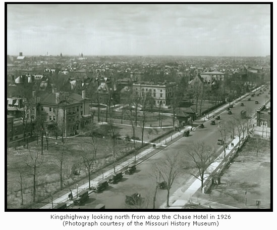
And here's a shot which just misses the northwest corner (taken from the roof of the Chase):
![]()
And one of my favorites: Easter Sunday in Forest Park. Looking towards the northwest corner, but you can't quite see what's hidden behind the trees:
![]()
In the meantime, here's the old Bixby House, which used to be on the northeast corner, where the Chase is now:

Another shot of the Bixby House:
And here's a shot which just misses the northwest corner (taken from the roof of the Chase):
And one of my favorites: Easter Sunday in Forest Park. Looking towards the northwest corner, but you can't quite see what's hidden behind the trees:

Incidentally, the site in question was originally referred to as #1 Forest Park Terrace.
I don't think that corner was ever developed - with a single family home or otherwise.
- 1,613
This link will take you to image #105 of Compton and Dry's famous Pictorial St. Louis, published in 1875. You can zoom in and click-and-drag your way around the drawing. It clearly shows farmland Northwest of Kingshighway and Lindell, with a modest house on Kingshighway about at Maryland.
Keep in mind, this was 1875. I don't know what may have come later.
This is the Library of Congress website. You can check out the entire map, and you could spend hours exploring it.
https://www.loc.gov/resource/g4164sm.gp ... 49,0.686,0
Keep in mind, this was 1875. I don't know what may have come later.
This is the Library of Congress website. You can check out the entire map, and you could spend hours exploring it.
https://www.loc.gov/resource/g4164sm.gp ... 49,0.686,0
I found an answer in the old Sanborn fire maps. The house there now was a carriage house for #2 Westmoreland place, which owned 4 lots on that corner. No sign of anything there before in any maps I have found.
http://cdm16795.contentdm.oclc.org/cdm/ ... 4/rec/6286
http://cdm16795.contentdm.oclc.org/cdm/ ... 4/rec/6286
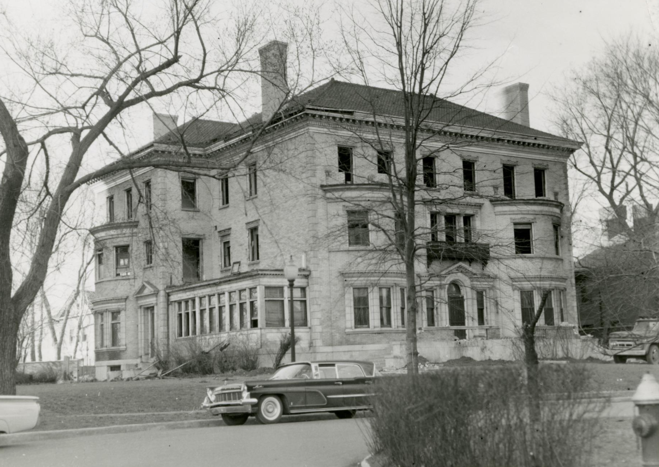
There was a VERY large house on the corner of Lindell and Kingshighway that I believe faced Kingshighway. The house was demolished approximately 1958(?). The carriage house(which is a very large carriage house) remains now as a single family home. I’ve never seen a picture of the house. My mother described it to me. She was a young woman newlywed and was curious about the house(it was getting torn down), and waltzed right up and asked the guys starting demolition if she could see the house. They let her wander through(imagine that today with safety precautions—and she was visibly pregnant).
- 113
- 2,663
I doubt it would ever be allowed, but some decent density on that corner would be **chefs kiss**
Yeah I'd love to see a 10-20 story apartment building there. Would make all the mansion owners so mad haha.
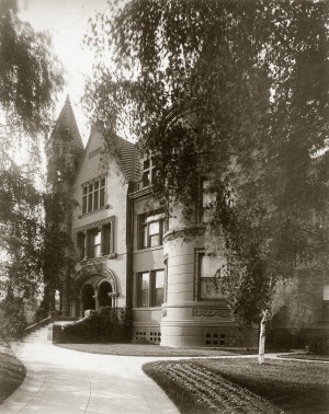
The house in that picture is listed as 2 Westmoreland Place on the site you linked - I think it fronted Westmoreland Place facing north, at the Kingshighway entrance... the little bulding behind it is what is today listed as 5015 Lindell. I don't think there was ever any house directly at the corner of Kingshighway and Lindell.johnnyqnola wrote: ↑Apr 19, 2023
It was a beaut, demoed in 1961.
https://images.squarespace-cdn.com/content/v1/5e1b4051f2fa43701e2f8da2/1581271034683-ILGU2PQXG7621BK8F5FS/2+Westmoreland+Place+East?format=1500w
sourced from: https://www.westmorelandplaceinstlouis.com/history

- 113
^You are correct DTG. I was just sharing a photo of the house that mdye was possibly referring to. From the 1958 aerial, it looks like it may have had a long walkway to Khwy, making it "feel" like it fronted that street since it does have a 2nd entry on the east facade.